Say Cheese! Now you can browse the justFRED.ca gallery by:
Home > justFRED 2008 > The River

Flood Map of Fredericton (PDF)

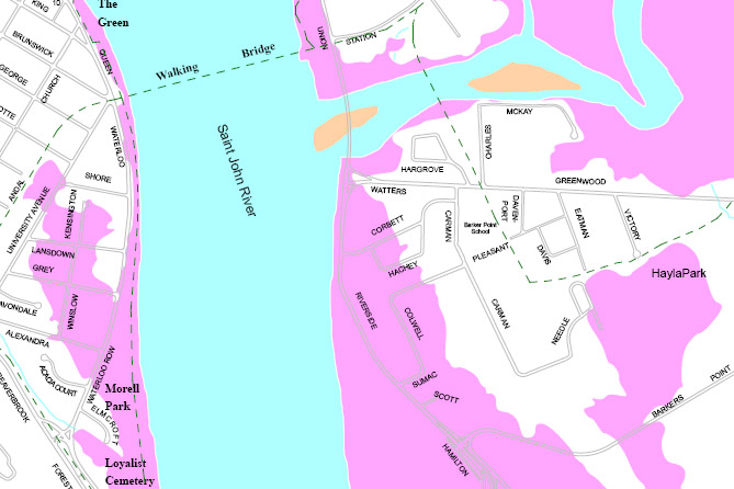
Click on the thumbnail to see an image of the areas near the walking bridge. Click on the image to see a full-sized PDF of the entire Saint John River section in Fredericton. The areas marked in pink will be underwater if and when the river reaches the 8 meter flood stage.

Map courtesy City of Fredericton.

Note: This image is NOT for sale.

cMG_0481.JPG IMG_9958.JPG flooding_8m.pdf aa0187.JPG IMG_0144.JPG
Rate this file (No vote yet)
Copyright © 2008 justFRED.ca. All Rights Reserved.  Made in Fredericton. Home | Member Login | Contact Us